
Concrete Pachometer Guide for Safer Drilling Plans
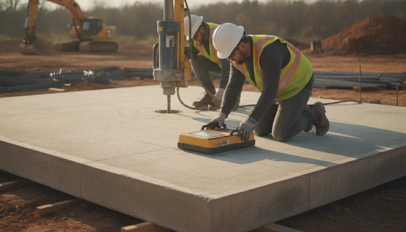
Before a core drill or saw reaches a concrete slab, treat its reinforcement as part of the work plan, not a surprise in the field. A concrete pachometer, also called a covermeter, is a nondestructive device that helps locate ferromagnetic reinforcing steel and estimate its depth below the surface.
Contact our Georgia demolition team
A concrete pachometer measures the position of steel reinforcement and the depth of concrete cover by detecting changes in the magnetic field around rebar. That information can help crews plan proposed openings and avoid cutting structural steel. It is planning information, not permission to drill. Review readings alongside drawings, field conditions, and qualified site judgment.
For Georgia construction and renovation professionals. The value is in connecting a focused reinforcement check with a larger question: what else may be concealed where the work is planned? Understanding the instrument's limits and when broader scanning may help starts with the measurement itself.
What Does a Concrete Pachometer Measure?
Rebar location and concrete cover
A concrete pachometer, also called a covermeter, is a nondestructive testing device. It locates reinforcing steel inside concrete and estimates the depth of concrete between the surface and that steel. A field team can gather this information without opening the slab first. The reading helps identify likely reinforcement and the cover above it. For a formal definition of covermeter testing, see the Wisconsin Department of Transportation inspection guidance.
The instrument responds primarily to ferromagnetic material. As it moves across the concrete surface, it detects changes in the surrounding magnetic field caused by materials such as steel rebar. The Iowa DOT explanation of covermeters describes this magnetic-field principle. In practical terms, a technician can use that changing signal to trace likely reinforcement lines, identify intersections, and record cover readings at selected points.
Why cover depth matters
Concrete cover is the protective layer surrounding reinforcing steel. It separates the steel from the outside environment and helps protect it from corrosion. Because cover contributes to the durability of reinforced concrete, measuring it can provide valuable information during inspection, renovation, and pre-work planning. The Iowa DOT technical reference on concrete cover connects accurate cover measurement with long-term structural integrity.
That information also matters before coring, sawing, drilling, or placing an embedment. Knowing the probable rebar layout can help a project team avoid an unplanned cut through structural reinforcement and choose a work location that fits the intended opening. NIST research on rebar location and safe drilling areas reinforces why reinforcement mapping belongs in the planning conversation before work begins.
What the reading does not tell you
A pachometer reading is useful evidence, not blanket authorization to drill. It indicates the location of ferromagnetic reinforcement and provides cover information at the points and conditions examined. It does not, by itself, establish the complete condition of a slab, identify every possible embedded utility, or replace review of drawings, field conditions, and the proposed work. It also should not be treated as a substitute for qualified site judgment.
For projects involving deeper or broader subsurface questions, the appropriate scanning method may differ. A pachometer has a focused role around ferromagnetic reinforcement and cover. GPR may be considered when the team needs a broader subsurface picture. The method, markings, and final work plan should be coordinated with the people responsible for the structure and the planned cut.
How a Pachometer Helps Plan Drilling and Cutting
Start with the proposed work
A useful scan begins before equipment reaches the slab. First, define the planned opening, core, anchor, trench, or cut. The size and location of the work area determine where reinforcement needs to be checked and how the findings should be marked. Review available drawings or prior documentation, but treat them as planning references rather than a substitute for current field information.
A concrete pachometer can help identify reinforcing steel and indicate its cover depth without damaging the concrete. The device responds to changes in the magnetic field caused by ferromagnetic materials such as steel rebar. This makes it useful for establishing where a proposed hole or cut may intersect reinforcement. The purpose is not to grant automatic permission to proceed. It gives the project team better information before concrete is disturbed.
Mark the work area
Once the scan is performed, the relevant indications should be transferred to the slab or another agreed project record. Marking the likely reinforcement pattern helps the drilling or cutting crew compare the planned work with actual site conditions. A clear mark should be tied to the proposed opening, not left as an isolated line that another trade must interpret later.
Locating reinforcement before drilling is important because cutting structural steel can affect the structural system. NIST describes rebar-location assessment as part of evaluating drilling areas before placing concrete embeds. That work highlights the value of resolving questions before the drill bit reaches the concrete. Read the NIST research on rebar location and drilling areas.
Accurate reinforcement information also supports protection of structural systems during modifications to existing buildings. This point is discussed in an academic paper on concrete infrastructure assessment.
Review the result with qualified judgment
Before drilling or cutting, the responsible project professionals should review the markings alongside the proposed work and known site information. Ask practical questions:
- Is the opening location still correct?
- Have nearby utilities, conduits, embeds, or post-tensioning concerns been identified?
- Has another trade changed the slab, wall, or work area since the scan?
- Are the readings clear enough for the decision being considered?
Reinforcing steel is only one part of the subsurface picture. A pachometer is focused on ferromagnetic reinforcement and cover indications, so it should not be treated as a complete map of every concealed condition. Method selection, interpretation, and the final go or no-go decision require qualified site judgment. Scanning reduces uncertainty, but it cannot remove the need to coordinate the work and respond to what is actually present in the field.
Concrete Pachometer vs. GPR Scanning: When Are They Different?
A focused reinforcement check
A concrete pachometer, also called a covermeter, answers a focused question: where is ferromagnetic reinforcement, such as steel rebar, and how much concrete cover sits over it? The device detects changes in a magnetic field caused by steel inside the concrete. This makes it useful when a contractor needs an indication of rebar position and cover depth before planning a penetration.
For example, a pachometer reading can show whether a proposed core location is close to reinforcing steel. That information can support decisions about placement. It can also provide information about cover, the protective concrete layer around reinforcement. Cover helps protect steel from corrosion, so cover measurements have relevance beyond a single drilling operation.
The Wisconsin Department of Transportation describes covermeter testing as nondestructive testing used to locate reinforcement and measure cover depth. The Iowa DOT explains the magnetic-field principle behind the method.
A broader subsurface picture
GPR scanning addresses a broader mapping problem. Rather than focusing only on ferromagnetic reinforcement and cover, ground-penetrating radar can help investigate subsurface features across a scan area. Depending on the conditions and the question being investigated, that broader view may support planning around reinforcement, possible conduits, voids, or other changes beneath the surface.
Results still depend on field conditions, the scan plan, and professional interpretation. GPR should not be presented as a guarantee that every hidden feature will be identified.
That distinction matters on renovation and demolition projects. A pachometer may be appropriate when the primary need is a targeted reinforcement check. A wider GPR scan may be more suitable when the proposed work could encounter several types of concealed features. NIST underscores the importance of assessing rebar locations before placing embeds or drilling. Academic work on concrete scanning also emphasizes protecting structural systems during modifications.
Choosing a method for the question
The choice is not always pachometer versus GPR. The methods can complement each other when a project needs both focused cover information and a wider subsurface review. Start with the proposed cut, core, embed, or demolition area, then identify what the team needs to know before work begins. Drawings and visible conditions can provide context, but they do not remove the need to evaluate the actual field area.
All Pro Demolition has verified GPR scanning capability and coordinates scanning with concrete cutting, core drilling, and demolition work in Georgia. When a project requires a broader review or coordinated next steps, explore professional concrete demolition services. In every case, scan findings are planning information, not permission to drill. A qualified project professional must review the result, account for field conditions, and make the final work decision.
Questions to Ask Before Concrete Coring or Cutting
A short pre-work discussion can prevent a last-minute change in drilling location or an avoidable conflict with the structure. The goal is not to treat one document or one scan as permission to proceed. It is to assemble the available information, compare it with field conditions, and identify the person qualified to make the final work decision.
- What drawings, as-builts, or structural details are available? Gather the latest plans, revision notes, slab information, and details for the proposed work area. Treat drawings and as-builts as useful references, not proof that conditions in the concrete match the paperwork. Ask who reviewed them and whether newer revisions may exist.
- What exactly is the proposed opening? Record the location, diameter or dimensions, depth, orientation, and purpose of the core or cut. A small adjustment to the opening can change the reinforcement or embedded-item conflicts that need to be reviewed. Mark the intended work area clearly before scanning begins.
- What utilities or embedded items are known? Identify known conduit, piping, post-tensioning concerns, embeds, reinforcement, and nearby building systems. Ask which trades or owners have information that is not shown on the drawings. Unknown conditions should remain an open risk, not be treated as clear space.
- Which scanning method answers this question, and what will be delivered? Ask whether a concrete pachometer reading is appropriate for the reinforcement and cover question, or whether broader subsurface mapping is needed. Confirm whether the deliverable includes marked field locations, a sketch, photos, measurements, or a written report. The method should match the decision, and the deliverable should be usable by the crew performing the work.
- How will the findings be marked in the field? Confirm the reference points, orientation, colors or symbols, and how the markings will remain visible through layout and setup. A result that cannot be matched to the proposed opening is difficult to use safely. Have the drilling or cutting crew review the marks before equipment is positioned.
- What changed after the scan? Revisit the decision if the opening moves, the dimensions change, the surface is repaired, access differs, or new information appears. A scan describes the area examined at that time. It does not automatically cover a new location or authorize work under changed conditions.
- Who makes the final decision to proceed? Name the responsible contractor, engineer, owner representative, or other qualified decision-maker before work starts. The scanning provider supplies project information, but the authorized team must interpret it with the drawings, scope, and site conditions. For coordinated planning, you can contact our Georgia demolition team with the work area and proposed opening.
Keeping these answers together gives the crew a clear basis for the next review. It also makes unresolved questions visible before the drill or saw reaches the slab.
For additional context on planning penetrations in Georgia, review this Georgia core-drilling field guide before finalizing the work sequence.
What Georgia Contractors Should Expect From a Scanning Plan
Share the work plan
A useful scanning plan starts with the work that will follow it. Before scheduling a scan, give the scanning contractor the project address, slab or wall location, proposed openings, approximate dimensions, and the intended method of work. Note whether the next step is core drilling, concrete cutting, demolition, or placement of a new embed. Drawings, marked-up plans, photographs, and available as-built information can add context, but field conditions still need to be evaluated on site.
Also identify practical constraints. Tell the contractor about access limits, occupied areas, work hours, finished surfaces that need protection, and any known utilities or previous modifications. If the proposed opening has moved since the plans were issued, provide the latest layout. These details help the scan address an actual field question rather than produce information that is difficult for the crew to use.
Coordinate scanning with the next trade
Scanning should be planned around the sequence of work. The person marking a proposed core or cut should be able to review the scan before equipment is positioned. That review can help the team consider visible reinforcement indications and other subsurface findings in relation to the planned opening. Research from NIST describes rebar-location assessment as part of evaluating drilling areas before placing embedments. That research reflects the value of resolving these questions before the drill bit reaches the concrete: NIST rebar-location research.
In Georgia renovation work, coordination is especially important when several specialty activities share a tight schedule. All Pro Demolition combines demolition, precision core drilling, and GPR scanning as an integrated service model. Contractors can discuss related work with one Georgia-based team. When the scope expands from a single opening to selective removal, connect the scanning findings to the broader plan for professional concrete demolition services.
Treat results as project information
The handoff should be clear enough for the field team to act on responsibly. Ask for the scanned area, the location and orientation of markings, the method used, notable indications, and any limitations that affected the work. Confirm which marks correspond to the proposed opening and which require review. Keep the handoff with the project records and communicate changes if the opening, equipment, or work area shifts.
A concrete pachometer can provide focused information about reinforcing steel and concrete cover, while broader scanning questions may require a different method. In either case, the result supports planning. It does not replace qualified site judgment, engineering review where required, or a final decision by the responsible project professional before coring, cutting, or demolition begins.
A Safer Decision Starts Before the Drill Bit
Good concrete work starts with a clear understanding of what may be inside the slab. Before drilling, coring, cutting, or planning an embed, use the proposed work area and the available project information to define what needs to be checked. A concrete pachometer can help identify reinforcing steel and indicate concrete cover, giving the team useful information before the first cut.
Scan before drilling or cutting
Begin with the actual work plan, not just a general scan of the room. Mark the planned opening, core, saw cut, or attachment location. Then review the area for reinforcement indications and any other conditions that may affect the planned work. This sequence helps the crew compare the intended location with what the concrete is showing in the field.
Markings should be interpreted alongside drawings, proposed dimensions, access limits, and the work of other trades. A reading is most useful when it answers a specific project question: Can the opening move? Is the planned cut crossing reinforcement? Does the work area need a different method or additional investigation?
Read the result in context
A pachometer reading is project information, not automatic permission to drill. Field conditions can differ from expectations, and a reinforcement indication does not by itself describe every condition below the surface. The person responsible for the work still needs to evaluate the proposed activity, site conditions, structural implications, and coordination requirements.
That distinction matters on Georgia construction and renovation projects, where drilling and cutting may need to fit around demolition, coring, utilities, and the next trade's schedule. When the question extends beyond a focused check for ferromagnetic reinforcement and cover, the team may need to consider whether a broader scanning approach is appropriate.
Turn readings into a coordinated decision
The safest handoff connects the scan to the work plan. Share the intended opening or cut, review the markings with the qualified site team, and update the decision if the location or scope changes. This keeps the scan from becoming an isolated measurement and makes it part of a controlled pre-work process.
For contractors across Georgia, the goal is not to replace judgment with a device. It is to make that judgment better informed before concrete is disturbed.
Contact All Pro Demolition about your Georgia scanning or drilling project
Frequently Asked Questions
What does a concrete pachometer measure?
A concrete pachometer, also called a covermeter, is a nondestructive device that indicates the location of ferromagnetic reinforcing steel and estimates the depth of concrete cover over it. The cover measurement describes the concrete layer between the surface and the reinforcement. See the Wisconsin DOT covermeter guidance for the testing definition.
How does a pachometer locate rebar?
The instrument detects changes in the magnetic field produced by steel reinforcement below the concrete surface. A technician moves the device across the planned work area, interprets the response, and marks likely reinforcement locations. Results depend on field conditions and should be treated as planning information, not automatic permission to drill.
Why use one before drilling or cutting concrete?
Knowing where reinforcement is located helps the project team review a proposed opening before work begins and reduce the chance of cutting structural steel. This is especially important for coring, anchors, embeds, and other slab penetrations. The National Institute of Standards and Technology identifies rebar-location assessment before drilling as a critical planning concern.
What is the difference between a pachometer and GPR?
A pachometer primarily focuses on ferromagnetic reinforcement and concrete cover. Ground-penetrating radar, or GPR, provides a broader subsurface mapping approach that can help evaluate reinforcement patterns and other possible features. The right method depends on the question, slab, access, and field conditions. Either method supports qualified site judgment rather than replacing it.