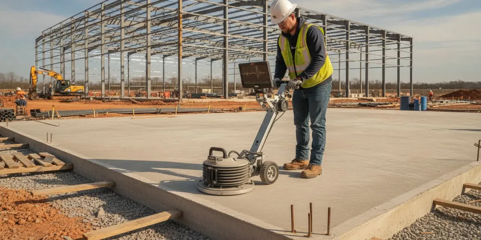
Ground penetrating radar concrete scanning gives a project team a way to investigate a concrete area before drilling, cutting, or selective demolition. The goal is not to create a guarantee that every hidden condition will be found. The goal is to gather useful field information, relate it to the proposed work, and give the responsible project team a better basis for deciding what happens next.
What question should ground penetrating radar concrete scanning answer?
A useful scan begins with a specific work question. A crew may need to create a concrete penetration for a pipe, electrical route, or other building system. Another crew may need to saw a defined opening or remove a section of slab. In each case, the question is more useful than a general request to “scan the floor.” The operator needs to understand the location, dimensions, method, and decision that the scan is intended to support.
For example, a contractor planning one core hole should identify the proposed center and diameter. A contractor planning a saw cut should provide the intended path, width, length, and approximate depth if known. A renovation team planning selective demolition should identify the area to be removed and any nearby work that could affect access or sequencing.
This distinction matters because scan coverage should correspond to the work. A scan of one marked location does not automatically evaluate a relocated opening several feet away. Similarly, information collected for a single penetration may not answer a later question about a long cut or a larger demolition area.
What can a GPR scan indicate in concrete?
Ground penetrating radar uses radar signals to record responses from changes below a surface. The equipment is moved across the accessible area, and the resulting patterns are interpreted by the operator. In concrete work, those responses may indicate reinforcement, embedded objects, or changes in the material that deserve consideration before intrusive work.
The output is an interpretation of field responses, not a transparent picture of the entire slab or wall. A response may help show where a feature appears in relation to the proposed opening. It may also help identify a location that warrants additional review or a change to the work layout. The level of confidence depends on the material, target, equipment, surface access, scan direction, depth, congestion, and other site conditions.
Teams should use careful language when discussing findings. A mark or reported response is evidence to evaluate. It is not automatically proof of an object's exact identity, condition, or structural significance. If the decision has serious structural, safety, or operational consequences, the appropriate design professional and project authority must remain involved.
For a related explanation of reinforcement location and mapping, see the guide to rebar mapping. It can help a project team distinguish between a broad mapping scope and a scan focused on a particular proposed penetration.
What can scanning not decide for your project?
A scan does not approve a hole, cut, or demolition sequence. It does not replace structural design review, drawings, permits, utility coordination, or the safety procedures required for the work. It also does not prove that an area is free of every embedded item. The absence of a clear indication should be treated within the stated limitations of the scan, not as an unconditional clearance.
Concrete conditions can make interpretation more difficult. Reinforcement may be closely spaced. A target may be deep, small, or positioned in a way that produces an ambiguous response. Moisture, surface coverings, uneven access, material changes, and nearby features can affect the information available. If the surface cannot be reached, that portion of the proposed work may not be covered.
Before work proceeds, the project team should decide who is responsible for interpreting the findings and authorizing the next step. Depending on the job, that may involve the general contractor, structural engineer, building owner, utility coordinator, or other designated authority. The scanning provider can report observations and limitations, but the scan alone should not be treated as permission to proceed.
When should a Georgia project schedule the scan?
Schedule scanning early enough for the findings to influence the plan. A last-minute scan immediately before a crew begins drilling may leave no time to move the opening, obtain a review, coordinate another trade, or address an access problem. Early planning is especially valuable on occupied commercial sites, renovation projects with multiple trades, and work with several penetrations or cuts.
During design coordination: Identify likely openings and routes before finishes, equipment, or temporary work restricts access.
Before mobilizing a drilling crew: Confirm the proposed center, diameter, elevation, and surrounding scan area.
Before concrete cutting: Mark the complete cut path and explain the planned sequence and material removal.
Before selective demolition: Define the area to be removed and identify adjacent sections that must remain.
After a layout change: Check whether the revised location was actually covered before relying on earlier findings.
Georgia projects can vary widely in building age, construction type, site access, and trade coordination. A downtown renovation, a commercial slab modification, and an exterior concrete project may require different scheduling conversations even when all three include drilling or cutting. The work plan should be based on the actual site rather than a generic scan area.
How do you prepare a useful scanning scope?
Give the scanning contractor enough information to understand the decision the project team is facing. The scope does not need to predict every field condition, but it should identify the work that the scan must inform.
Describe the concrete element: State whether the work concerns a floor slab, wall, beam, deck, foundation, or another element. Include documented thickness or drawings when available.
Mark the proposed work: Show each hole, opening, cut line, or demolition boundary. Include dimensions and reference points that can be found in the field.
Explain the planned method: Identify whether the next step is core drilling, slab sawing, wall sawing, hand demolition, or another method.
Share known information: Provide drawings, photographs, prior reports, visible penetrations, and known utilities or building systems.
Describe site constraints: Note access hours, occupied rooms, floor coverings, equipment, restricted areas, dust or water concerns, and any required coordination.
Identify the handoff: Confirm whether the result will be field marks, written notes, photographs, a plan markup, or another agreed format.
Clear reference points are particularly important. A mark that cannot be related to the project layout may be difficult for a later crew to use. Explain who will be present, who will receive the findings, and what happens if a response overlaps the planned work. These details turn a scan from an isolated field visit into part of the project workflow.
What happens during a typical scan?
First, the operator reviews the agreed scope and confirms the accessible area. The site team may need to move stored materials, remove temporary coverings, or expose enough surface to examine the intended locations. The operator then surveys the area with the appropriate equipment and records responses across the planned coverage.
Scanning patterns should relate to the question being asked. A point penetration, a long cut, and a broad demolition area do not have identical coverage needs. The operator interprets the responses in the context of the surface, proposed work, and available project information. Where appropriate, findings are marked or documented so that the project team can compare them with the layout.
At the end of the visit, ask for a practical handoff. The crew should know what was examined, where the scan boundaries were, what responses were reported, and what limitations apply. If the findings require a design review or a change in location, that issue should be visible before intrusive work starts.
Scanning may be coordinated with the next concrete operation. For background on matching a penetration to the right method, review the concrete drilling services guide. The purpose is not to combine every task automatically, but to make sure the investigation and the planned work are discussed together.
How should teams use findings before core drilling?
Core drilling creates a circular penetration, so the proposed center and diameter are central to the review. The team should compare the marked location with the actual layout and verify that the slab or wall being examined is the one where drilling will occur. If the center moves, the team should determine whether the new location is within the examined area and whether the change affects the decision.
The scan may indicate a response that conflicts with the proposed hole. That does not mean a field worker should simply move the hole without review. The revised location may affect the design, the route of a building system, the sequence of work, or the scan coverage. Document the decision and make sure the drilling crew receives the current layout.
For a deeper look at the planning conversation around penetrations, read the concrete core drilling project guide. It covers the type of information that helps connect an opening request with the work that follows.
How should teams use findings before concrete cutting?
Concrete cutting requires attention to the complete path, not just one point. A response near one end of a proposed line may affect the sequence even if the opposite end appears clear. Mark the intended path in the field, confirm the planned depth and extent, and compare the full line with the scan information.
When a cut must move, confirm the new path before the saw crew begins. Also review what will happen to the removed section, nearby finishes, water management, dust control, and access. Investigation is only one part of a workable cutting plan.
The Georgia concrete cutting planning guide provides related questions about method, site coordination, and preparation. Use it as a companion to the scan scope rather than as a substitute for project-specific review.
How should a scan handoff be documented?
A useful handoff lets a person who was not present understand what was investigated and how the information relates to the next task. Depending on the agreed scope, it may include marked locations, photos, notes, a sketch, or a written summary. The important point is that the record should identify the coverage and the limitations.
Record the date and area examined.
Relate marks to visible reference points or the project layout.
List the proposed openings or cut paths that the scan was intended to address.
Describe reported indications without overstating their identity or certainty.
Note areas that could not be accessed or conditions that affected interpretation.
Give the current information to the supervisor and crew performing the intrusive work.
Update the handoff if the layout, dimensions, or work sequence changes.
Do not let a scan mark become detached from its context. If a different crew sees a line or symbol but does not know the boundary, date, or purpose, the mark may be misunderstood. A short briefing before drilling, cutting, or demolition helps connect the field information to the approved work plan.
How does scanning fit with demolition coordination?
Scanning can support selective demolition when portions of a concrete element must remain or when a planned opening is near systems that the project team needs to understand. The demolition scope should still define the area, sequence, temporary controls, access, and removal method. A scan is an investigative input, not a complete demolition plan.
When several services are needed, a single point of coordination can simplify the handoff. All Pro Demolition offers demolition, concrete cutting, and core drilling services. You can review the core drilling and GPR scanning service page to discuss a project scope. For broader removal and cleanup planning, see the demolition and debris removal guide.
What safety questions belong in the work plan?
The responsible project personnel should coordinate the scan with the wider site safety plan. Discuss access, work-zone control, nearby occupants, equipment movement, dust, water, electrical hazards, and the controls required for drilling, cutting, or demolition. The scan does not replace applicable regulations or the employer's procedures. OSHA provides general construction safety information at its official website; project teams should consult the requirements applicable to their work.
Also establish a stop-and-review process. If the field layout differs from the scan, an unexpected condition appears, or a crew cannot identify the intended coverage, pause and ask the designated project decision-maker for direction. A clear escalation path is more useful than relying on an assumption made at the work face.
What should you ask when comparing scanning proposals?
Price alone may not show whether two proposals address the same question. Ask each provider to describe the coverage, surfaces, number of locations, expected handoff, access assumptions, and exclusions. Confirm whether the proposal covers the actual hole sizes or cut paths and whether a return visit would be needed if the layout changes.
What exact areas and concrete elements are included?
What information should be supplied before the visit?
How will findings be marked or documented?
What limitations could affect the scan?
Who should attend the handoff and review?
What changes require additional investigation?
How does the timing fit the planned drilling, cutting, or demolition?
A comparable scope helps the project team make a practical decision. It also reduces the risk of discovering after the visit that the proposed opening moved, the surface was inaccessible, or the documentation did not match the crew's needs.
Frequently asked questions about ground penetrating radar concrete scanning
Does ground penetrating radar concrete scanning show everything inside concrete?
No. It records responses that an operator interprets under the conditions present at the site. Material, depth, congestion, access, and target characteristics can affect detectability, so the result should be understood with its stated limitations.
Can a scan declare a location safe to drill?
A scan can inform the evaluation of a proposed location, but it does not by itself approve the penetration or establish structural suitability. The designated project authorities must review the findings and authorize the work.
Do we need drawings before requesting a scan?
Drawings are helpful when available, as are photos, proposed dimensions, reference points, and known information about the concrete or building systems. These materials help define the question, but they do not replace field investigation.
What if the opening changes after the scan?
Tell the project team and confirm whether the revised location or path was covered. Do not assume that findings from one location apply automatically to another. The change may require additional scanning or review.
Can scanning be scheduled with drilling or cutting?
Yes. Coordinating the investigation with the planned operation can make the handoff more useful. Share the work method, dimensions, locations, schedule, access limits, and documentation needs when requesting the quote.
Contact our team about your project
Start with a defined work question, scan the area that matches the actual layout, and make sure the crew understands both the findings and their limits before concrete work begins.